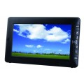
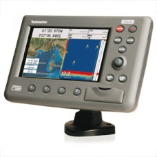
Techmarine T50.05
Τιμή: 0,00€
Άνευ ΦΠΑ: 0,00€
Άνευ ΦΠΑ: 0,00€
Techmarine T50.05
- Worldwide Built-in Cartography showing detail up to 2.0 NM
- C-MAP by Jeppesen MAX charts compatible
-
Object-oriented chart system with enhanced functionality including:
- Guardian alarm, Safety Status Bar, Safe Route Checking
- Perspective View
- Satellite Image Coverage (on worldwide background)
- Turbo and Smooth Zoom
- Multilanguage
- Enhanced Port Information database
- Tides & Currents data
- Photos & Diagrams
- Automatic Information on all chart objects and User Points
- Find function for Ports Services, Ports By Name, Ports By Distance, Tide Stations, Wrecks, Obstructions, Lakes Information
- 5,000 User Points: Waypoints/Marks
- 1,000 Track Points
- 3 Tracks
- 25 Routes
- User Points Icons 16
- Create, Move, Insert, Edit, Delete, Send, Receive Waypoint
- Create, Move, Edit, Delete, Send, Receive Mark/Event
- Navigation to Goto
- Create, Save, Name, Edit, Delete, Send, Receive or Follow a Route
- Route Data Report and User Points (Marks/Waypoints) List pages
- Display vessel's position, direction and Track
- Man OverBoard (MOB) to navigate back to a missing person or object
- Weather Service capability
- Range & Bearing function
- Simulation Mode with cursor control
Γράψτε μια κριτική
Το Όνομά σας:Η Κριτική σας: Σημείωση: δε μεταφράζεται η HTML!
Βαθμολογία: Κακή Καλή
Εισάγετε τον κωδικό στο παρακάτω πλαίσιο:

